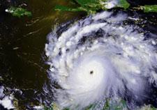
Get a picture of 150 years of hurricane history in your area using the recently enhanced Historical Hurricane Tracks website from NOAA (US National Oceanic and Atmospheric Administration). For those in the eastern half of the continental US, the image can be quite dramatic. 
If you haven’t thought much about hurricane preparedness, this graphic representation of hurricane paths through your neighborhood may move you! Simply enter your zip code or city/state in the “Enter location” field of the Search area of the hurricane tracking map and click the “Go” button. The web tool will plot the paths of hurricanes that have come through your area. The path color indicates the intensity of each storm as it strengthened and weakened, click on a path to view date, name and atmospheric information for the storm. A similar tracking map for tornadoes is available in the Tornado section of these disaster planning resources.
NOAA reported, “The site’s popularity with the public was evident as Hurricane Irene bore down on the U.S. East Coast. Tens of thousands of people used Historical Hurricane Tracks to compare the National Hurricane Center’s projected path of Irene with past storms.”
Check your hurricane history, and then explore the rest of the CERF+ Studio Protector site to learn more about what you can do today to prepare for a hurricane and other emergencies.


